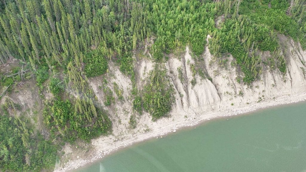
The Mackenzie River in the summer of 2019. Photo: APTN file
Canada’s longest river is at historically low levels, stranding communities that rely on it for essential goods and alarming First Nations along its banks who have never known the mighty Mackenzie to be so shallow.
“This has never been seen before,” said Dieter Cazon, looking out at the water from his office as land and resources manager for the Liidlii Kue First Nation at Fort Simpson, N.W.T.
“We’ve asked elders, ‘Does anybody have stories about water being this incredibly low?’ Nobody has these stories.”
From Great Slave Lake to the Beaufort Sea, the Mackenzie River is 1,738 km long. Its watershed covers parts of five provinces and territories.
But the Northwest Territories government reports flow rates at most locations along the river are either well below average or at their lowest recorded value for this time of year.
Below average
Water levels are about two metres below average, said territorial hydrologist Ryan Connon. Normal seasonal fluctuations are about 50 centimetres.
“Being two metres lower than normal is quite significant.”
That drop is even more dramatic, because two years ago rivers and lakes in the Mackenzie system were at all-time highs.
“The fact that water levels have dropped so much, that’s definitely unprecedented,” Connon said.
Last week, the Canadian Coast Guard abandoned attempts to monitor and mark hazards along almost the entire territorial length of the river. The coast guard’s two buoy tenders are limited to the lake itself and a short stretch of river north of Aklavik.
“We’ve been unable to provide our usual on-water presence on the river so far in 2024,” said spokesman Jeremy Hennessy in an email.
“River users should use extreme caution if venturing out, and keep in mind that any buoys in this section of the river are unreliable.”
No all-season roads
There are no all-season roads along most of the river’s valley. Communities are supplied by air or river barge for essentials from groceries to building supplies.
“Pretty well everything, even our fuel,” said Douglas Yallee, mayor of Tulita, N.W.T., a village on the river about halfway up its length. “It is affecting the resupply of our community.”
Yallee said he worries that having to fly in supplies will increase costs for a community that can ill afford it. As well, he said Tulita’s supply of aviation fuel is low as the wildfire season proceeds.
“Fire season’s back, and they’re going to be burning up a lot of fuel.”
Nor is the low water limited to the Mackenzie. Great Bear and Great Slave Lakes are at or near their lowest-ever levels, as are smaller rivers feeding into the Mackenzie.
Plans to dredge
The territory has plans to dredge the Liard River to ensure the ferry that provides Fort Simpson’s only road link to the south remains viable.
“We’ve been experiencing extreme drought over the entire Mackenzie River Basin over the last two years, coupled with extremely high temperatures,” Connon said. “We’re definitely seeing a climate change signal.”
The Mackenzie is central to life in the area. That part of the territory is known as the Dehcho — Dene for “Big River.”
But long sandbars are popping up where none were before. Rocks once submerged by the current are bare and dry. Banks once kilometres apart are closer together than ever.
“To see it so dry, it’s pretty crazy,” Cazon said.
Declining water is causing social, economic and environmental concerns, he said. It’s starting to change a way of life that has existed for centuries.
“We’re river people,” said Cazon.
“Traditionally, you’d be able to go up these creeks and stuff to go hunting, but getting into the bush is getting a little bit harder. If it goes too long, issues of food security start popping up.
“Climate change sucks.”


